Ascenté Revisited

IMG_5163

After working SO hard to garner an approved Tentative Map, the owners of the Ascenté property, Symbio LLC, have put the project up for sale.   It would appear that the big builders including Toll Brothers aren’t interested, so the project is on the market, listed with Dickson Commercial Properties. The three “Villages”, Sierra, Tioga and Whitney are listed as separate properties.   Their website (https://images1.loopnet.com/d2/p_5eEG1sUfO2jH3ljwQ4ykFcYa6LUEPGFmM_M33tm6s/document.pdf) advertises the following:

Dickson Commercial Group is pleased to release the following for-sale offering of Ascenté, a 225 lot luxury single-family residential development in Washoe County, Nevada. Ascenté may be purchased by individual Village or in one bulk purchase by pre-qualified developers, builders, and/or investors at the following prices:

Sierra Village     $4,200,000 ($62,687 per lot)

Tioga Village      $5,350,000 ($90,678 per lot)

Donner Village   $7,950,000 ($96,951 per lot)

Whitney             $2,550,000 ($150,000 per lot)

TOTAL                 $20,050,000 ($90,089 per lot)

Symbio LLC purchased Ascenté property for $7.2 million, thus a tidy profit if all four villages are sold.

Included in Ascenté purchase:

  • Approved Washoe County Tentative Map
  • Water rights and TMWA Area 15 “Facility Fee Credits” available from Seller
  • Preliminary engineering plans for the construction of backbone improvements
  • Cost estimates to develop finished lots (backbone infrastructure thru in-tract improvements)
  • Site geotechnical investigation report suitable for final map application
  • Design Guidelines


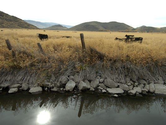
Symbio has spiffed up the property entrance via Brushwood we can assume to suggest that this is an approved access, which it is not.   Serious buyers might look at the property at this entrance and at Shawna and Patti Lanes, with the nice new grading and gravel and have a favorable impression of overall site access. The neighbors who fought to prevent the tentative map approval of Shawna and Fawn Lanes as the access points for Ascenté will remember that the traffic study was bogus and that all construction traffic must use only these two entrances to the property.

Questions:

  • How does selling the villages as separate units affect development and installation of supporting infrastructure, including access, road upgrades, sewer, water and power?
  • How will the Whitney Village be accessed if sold separately?   Which “buyer” will be responsible for allowing the access roads from the Tioga and Whitney Villages to be constructed?
  • How does the deconstruction of the Tentative Map components affect how the blasting, hauling and grading process?   For instance, we might assume that the Sierra Village will be sold first because it has the easiest access, through Fawn Lane.   Once this Village is built out, how will the new residents feel about the blasting and hauling of dozens of heavy-duty earth moving equipment through their Village on a daily basis for the years it will take to construct the access road and creating the Tioga Village up on the Steamboat Hill immediately south?   Will the new owners/builders of the Sierra Village mandate that every home buyer sign an agreement to allow this activity? Would the Sierra Village owners even care?   How does this work exactly?
  • Most importantly, how will the sale of these four Villages affect the status of completion for the 134 Conditions placed on the Tentative Map approval (https://washoerap.com/about)? The advertisement blithely boasts of a completed site geotechnical investigation “suitable for final map application”.   Italics mine.   I beg to differ.   Have the County Planners already seen a geotechnical investigation report (which would be prepared by Lumos Associates)?   If so, have they actually approved it? And with what sort of peer review process? We know that the County Planning Department does NOT have a registered geotechnical engineer on staff, nor have they procured the services of an independent consultant to do so. I made a technically-detailed case for oversight of the Lumos geotechnical work in a letter to Trevor Lloyd and Dwayne Smith at the Planning Department (LINK: https://washoerap.com/2017/12/).   I never received a response.
  • Of the 134 conditions, the most concerning for the health, safety and environment of the Callahan/Fawn Lane residents, as contained in our Appeal from June 2017 (https://wordpress.com/page/washoerap.com/3) include but are not limited to: consistency with the Forest Area Plan, traffic management (invalid traffic study), stormwater runoff management, water supply, fire protection, sewage treatment capacity as the County Planners and commissioners neglected to include the cumulative impacts of other approved development in the Mt. Rose Corridor.

Should these four Villages actually be sold to four different buyers, how will the County manage final build-out approvals with each entity separately applying for various construction permits based on ONLY ONE tentative map?   It is extremely likely that some of the tentative map components such as infrastructure layout and traffic control must change to accommodate each parcel.   As an example, what if a buyer only wanted to purchase the high-end Whitney Village and needed to build out the access roads across the as-yet unpurchased Sierra, Tioga and Whitney Villages?   Would that buyer have to procure rights to build the access roads across the other properties, thereby taking on an extra expense?   How would the infrastructure installation (which must be provided by Washoe County) be managed in this case? Should the Tentative Map not be re-written and re-submitted for each Village?   What does the NRS say about this? Is there a requirement and a process for amending tentative maps to reflect yet another subdivision of ownership and management of build-out?  How would each owner ensure that their Village has at least two access roads, should the build-out NOT proceed as described in the Tentative Map.

Will potential buyers do their due diligence and ask these same questions of Symbio, and the County Planners?

Let’s take a look at the Washoe County Development Code. (http://epubs.nsla.nv.gov/statepubs/epubs/322128-2016April.pdf)

Nevada Revised Statutes (NRS) CHAPTER 278 – PLANNING AND ZONING contains definitions for “final map” and “subdivider”.   What happens when OWNERSHIP of a Tentative Map is subdivided? Who then is responsible for addressing the conditions of approval and what are subdividers’ responsibilities to the other Village Owners, to the County and to the neighboring residents?   What are the County’s responsibilities to ensure that the “character” and constructional integrity of build-outs are maintained?

I know this blog is all questions and no answers. That does NOT work to the benefit of existing residents, does it?   Let’s hope that the sign graffiti serves as a robust warning to potential buyers. This project is bogus. Symbio knew it all along, and so did the Washoe County Commissioners.

Update: A thoughtful resident just pointed out to me that, as per our appeal argument, IF the County Planners and Commissioners HAD made Ascente adhere to the Forest Area Plan, an access road would be constructed to connect from the Thomas Creek Intersection.  This also could have been extended down toward the Symphony Ranch development to alleviate the traffic congestion there.   Oh well.  Too much bother, I suppose.   Kris

Silver Knolls Development Denied

Guest Post by Mike Lawson

Last Tuesday’s Washoe County Planning Commission meeting provided a pleasant departure from the malfeasance we have witnessed at recent Reno city council and Washoe County commission meetings.As should be expected, the Washoe county planning commissioners did their due diligence in investigating applicant claims that their proposed project would benefit the existing neighborhood at Silver Knolls.

Despite the contention from Fire Chief Moore that fire protection should be the least of the County’s concerns, thoughtful citizens and planning commissioners recognized the truth of the existing response time (over 18 minutes) would not improve simply because new homes were proposed to be built. Chief Moore in later testimony claimed he had no special interest in the project (despite his earlier advocating for it) but offered conflicting testimony about when fire-fighting resources would be allocated to the north. In one breath he claimed he was not getting anything from the developer and in the next said the developer was willing to provide money for new infrastructure. The most puzzling part of chief Moore’s testimony was when he admitted response time would be reduced from 18 minutes to 2 minutes by moving an existing station, then saying he would do it when the demand was there. Seems to me and the residents of the north valleys that the demand is already there without the “new” homes, so what the hell is the delay?

Community advocate Russel Earl provided the most thoughtful testimony in public comment by providing an alternative traffic study commissioned and paid for by the community that rebutted the applicant traffic study. This is a prime example of not being able to trust engineering and other reports bought and paid for by applicants and it is an issue the county hopes will go away. As neighborhood activists we must continue to be diligent in questioning the veracity of these reports that serve the few at a cost to the many. Mr. Earl also mentioned the cost of development is not covered by the fees the developers pay despite continued assertions made by the applicant and offered a specific example about the Red Rock road expansion. Having served on the Regional Road Impact Fee technical advisory committee for RTC the past two years I can corroborate Mr. Earls contention in this regard. After they get credit for their “offsets costs” that go to building the local roads internal to the subdivisions they are profiting from, there is very little “money” that actually goes to regional road improvements.  And, while developers really don’t even pay their fair share to the impact on regional roads, they pay NOTHING for impacts to the State Highway system (e.g, US 395 etc.), schools, police and fire staffing, etc. If we had responsible elected officials at the city and county level, they would require supporting documentation that a specific development pays for itself rather than continuing to support and parrot that unsubstantiated claim every time a new development comes before them for approval.

Beyond Mr. Earl’s testimony, there was considerable public input that was poignant and relevant but much too exhaustive to cover here. There were also a few public comments made in favor of the proposal mostly centered on jobs and value to people who do not LIVE here yet. It was not surprising the “public” support for the development came from those that either worked directly for the applicant or those that would financially profit from it.

Newly elected Chairman Larry Chesney made a succinct argument that he could NOT make ANY of the findings required for approval, that the application flew in the face of an area plan prepared by the EXISTING community, and that there was no way he could support it. The Planning commission voted unanimously to DENY the proposal and to DENY the zoning change.

I am encouraged by the critical thinking demonstrated by the Washoe County Planning commissioners and can only hope it is a sign that all future development will be more carefully scrutinized.

TMWA Meeting – Lemmon Valley Water Management and Responses to Open Letter (https://thisisreno.com/2019/04/tmwa-admits-lemmon-valley-flooding-affecting-water-supply-wells-opinion/)

May 28, 2019 2pm

Attendees: John Enloe, Director Natural Resources, Greg Pohll PhD, Principal Hydrogeologist, Andy Gebhardt, Director, Operations and Water Quality, Kris Hemlein, Washoe Resident

We opened the meeting by reviewing previous correspondence from (Lemmon Valley) LV Residents to TMWA, Andy Gebhardt’s responses to their questions on April 23, John’s email to Steve on April 25 stating that two LV extraction wells were shut down due to flooding.

  1. I explained that I got involved as a citizen with professional experience in hydrogeology and wrote up my questions and requests for information in letter form which we decided to submit to “This Is Reno” for publishing.   TMWA was not pleased that I had my letter published in This is Reno, as they felt it was misleading in that it insinuated that the water quality for TMWA’s customers in Lemmon Valley was compromised. “I don’t understand why you couldn’t have just sent the letter directly to us. We would have happily given you all the information you need, without having to make it public. Once this meeting is over, I think you will agree that TMWA’s involvement in the Swan Lake flooding is non-existent. We have explained this to the LV residents over and over again. Tammy Holt Still keeps talking about the 2 million gallons/day coming from the Fish Springs well supply system. That water is being used as supply to our customers, not discharging to Swan Lake.   We have tried to explain this to them over and over to no avail.”
  2. John stated that Andy Gebhardt met with Bob Conrad (This Is Reno editor) to complain about the title of my letter/article and to try to set the record straight – that TMWA is NOT responsible for LV flooding and that our water quality has not been impacted ( TMWA added).
  3. They presented me with a notebook containing all the information I requested in my letter. We reviewed the contents of the notebook, particularly the extraction wells locations and the pumping information.
  4. I asked whether they were concerned about contamination due to infiltration of surface water.   They have sampled the LV wells frequently and have so far not found any evidence of contamination from surface sources.
  5. They provided a cross section depicting the depth and extent of the “clay layer” referenced by Dwayne Smith in his LV remediation discussions. The cross section utilizes the well logs from LV7, 8 and 6, Northwest to southeast. The thickness of the clay beneath Swan Lake varies from 50 to nearly 400 feet (TMWA removed).
  6. We discussed the East and West LV basins, separated by the Airport Fault. TMWA uses the West LV basin for groundwater recharge/storage and a pilot program is underway there evaluating the feasibility of storing additional water underground on Washoe County property north of the airport, but not the East LV basin, where Swan Lake and LV WTP is located. No water injection takes place in the East LV basin, except for a small test well located near the Reno-Sparks treatment plant where an injection test will take place next month at 15 gallons per minute for 2 – 3 months (less than 6 acre-feet in total).
  7. We discussed the LV Residents’ concern over the 2 million gallons a day extracted from 2 Fish Springs wells to augment water supply. The LV Community suspects that this water is contributing to Swan Lake flooding. In 2019 TMWA only recharged the Silver Lake well, which is in West LV Basin, in the amount of 45 acre-feet, and therefore not contributing to the Swan Lake flooding. Andy Gebhardt provided additional information regarding the amount of recharge taking place via injection at the two Silver Lake wells and reiterated that the Silver Lake wells are in the West LV Basin and not hydrologically connected to the East LV Basin, therefore not contributing to the water balance in that basin.
  8. We discussed the 40 feet of piezometric loss in the East Basin due to groundwater extraction since the 1970s, as depicted on a hydrograph provided by TMWA. Groundwater is beginning to rebound since the flooding began in 2017 and groundwater pumping was reduced. In 2019 groundwater levels are 20-60 feet below Swan Lake indicating that the aquifer does not discharge to the lake.
  9. I asked whether the LV Community group has technical/professional assistance to help them understand the issues and the remedial options presented by the City/County engineers. They told me that Mark Walker, UNR professor of Natural Resources has been assisting the LV community.
  10. TMWA is working with the Western Regional Water Commission and others (Reno, Washoe County, UNR) to evaluate the feasibility of additional groundwater recharge/storage in the Stead area (West LV Basin, at the Washoe County property mentioned previously, north of the Airport) as well as evaluating the feasibility of upgrading the Reno-Stead WTP to A+ water quality standards for injection purposes. Potential implementation of such an option, if feasible, is several years away.
  11. We discussed options for LV residents in the Hepner Subdivision, still on domestic wells and septic systems. AB 42 provides a financing option for residents to help pay for hooking up to municipal water system. TMWA states that putting these homes on the municipal water system is a prudent strategy if domestic well owners are concerned about their water quality.   They did not comment as to whether the Hepner Subdivision septic systems are a possible eventual source of contamination to surface or groundwater in East LV Basin.

Subsequent to the meeting I asked for clarification on several items:

  1. The thickness of the clay layer that Dwayne Smith references as being “protective of the LV aquifer” is correct in that estimates of 50 – 400 feet of clay underlies the area around Swan Lake playa. Following TMWAs recent evaluation of the hydrogeology in Lemmon Valley, they believe the thickest sections of clay are limited to the area beneath Swan Lake playa. Airborne resistivity mapping done by Washoe County shows lowest resistivity values (which is indicative of fine sediments) beneath the playa, with values increasing laterally, which supports TMWA’s conceptual model. Borehole logs are also consistent with this interpretation.
  2. The clay horizon does thin as you move away from the playa, and there is a one borehole beyond the western edge of Swan Lake that does not have any fine sediment.
  3. The clay lens does exist to a depth of approximately 20 ft in the south end of the Hepner Subdivision, but transitions to granodiorite at the north end. This could be a concern as the clay acts as an impermeable barrier to downward infiltration of surface water/fluids and therefore there might be a possibility that leachate from the Hepner Subdivision septic and leach fields could migrate downward into the aquifer.
  4. I asked TMWA if they have an estimate of the amount of available storage exists in the West LV basin. They stated that they are currently developing a groundwater model for all of Lemmon Valley which will be used to determine the storage potential.
  5. I asked why East LV basin recharge/storage is not considered feasible/practical. TMWA stated that they do not have an operational reason to recharge groundwater in the East LV basin. In the West LV basin recharge operations have been necessary to improve and maintain groundwater water levels, which benefits both municipal and domestic wells in that area. Also, water levels in Golden Valley (East LV) have been increasing toward land surface which is why Washoe County stopped injecting in 2016 or 2017. Back to Question 4, if there is available storage, why not encourage the active ingress of water by injection as a way to manage overall water storage issues in LV?

In summary, TMWA states that their water management processes are not responsible for the LV flooding, nor does the flooding impact water quality or supply infrastructure in LV. But can they be part of the solution to LV flooding?   TMWA has the financial means, technology and infrastructure to be part of the long-term solution.

Assembly Hearing for SB327 – Short But Only Sweet For Developers

I attended the Assembly hearing yesterday morning to review SB327, the bill that will allow expedited land development.

Original Bill Summary: Revises provisions relating to land use planning. (BDR 22-883)

Current Bill Title: AN ACT relating to land use planning; defining “residential dwelling unit”; authorizing the governing body of a county or city to provide for the division of land into five or more lots in an ordinance for planned unit development; and providing other matters properly relating thereto.

I made the following observations:
1)  Alex Assefa, Democrat from Clark County made pronounced commentary on whether this bill addresses the real issue of affordable housing in NV.  The gentleman member seated to his left (I wasn’t able to identify) made a point about the need for “starter homes” and Mr. Assefa pressed that starter homes and affordable housing are two VERY different types of housing.  One is based on an upwardly mobile family unit, and the other must serve the working class with very limited upward financial opportunity.   Mr. Assefa is rightly concerned that this bill does NOT address the need for affordable housing.
2) Gregory Hafen a Republican from Nye county stated that he works as a developer and sees a “need for this bill”.  What he SHOULD have done is immediately recuse himself because he stands to benefit financially if this bill should pass.
3) John Ellison, a Republican from Elko county stated that “fast is always better” in response to Aaron West’s comment that developers “lose $5,000/per lot per year” as a result of the current tentative map approval process, and that the purpose of SB327 is to get product to market faster.
Am I the ONLY one who sees what is happening here?   The product that is really needed is AFFORDABLE HOUSING and the proponents who spoke in favor, Aaron West (NV Builders Alliance) and Angela Fuss (Head Planner for Lumos Assoc., engineers and planners working exclusively for developers) will financially benefit from passage of this bill. as will at least one of the Assembly members, Mr. Hafen and the sponsor, Senator Kiekhefer, who’s law firm McDonald Carano represents the Stonegate developer.  It is apparent that he is sponsoring a bill specifically to favor developers as clients.
The hearing was a farce and did nothing to elucidate ANY altruistic need for this outrageously corrupt bill.   Affordable housing?   Really?

The hearing on this bill lasted only 45 minutes.   Only one person spoke in favor of the bill: Ms. Melinda Smith, representing the Builders Association of Nevada.  Surprised? Not.

Three people spoke against the bill, all offering very salient points as to why this bill is not only totally unnecessary, but only benefits developers at the expense of existing residents and environmental concerns:

Mr. Patrick Donnelly, representing the Center for Biological Diversity, linked this bill to the increasing threat of urban sprawl and poor environmental planning.  He also linked this bill to those who are working on the Lands Bill.

Ms. Maxine Meeks, a former Carson City Planning Commissioner, spoke against this bill, stating that the public review process is “the heart and soul” of the PUD and that this bill effectively prevents citizen participation.

Mr. Mike Lawson, Washoe County Planning Commissioner for District 2 made the following comments:

The current process under NRS 278 is for a development to be completely designed so that individual residential lots and many details are defined. This requirement ensures the design can be reviewed for tentative map approval. Engineering reports need to be submitted to show that there is traffic capacity, water availability, sewer treatment capacity, and flood control before the development can be approved by the planning commission at the tentative-map step in the only step that gets public review and input. Under SB327, the primary developer can submit a plan for a Planned Unit Development (zoning exception) and tentative map including superpads which have no design details. The primary developer could sell the superpads to commercial builders who would complete the detailed design for these large tracts. This creates several issues including but not limited to the following:

  • Under SB327, the development is never reviewed in its entirety. Neither the planning commission nor the public gets to consider the finished product.
  • If the primary builder grades the entire project but the superpads don’t sell, we have a mammoth scar on the landscape for the indefinite future with erosion and other hazards.
  • SB327 is written so that the primary developer may include estimates of water, traffic, sewer, emergency services, and other impacts the development will produce.
  • SB327 would not require the primary developer to submit his plan incorporating superpads to the planning commission for review. The City or County could designate a manager or other professional to review the plan with no public review.
  • • SB327 would not require the secondary developers to submit any engineering reports regarding the tract plans. So, no one is responsible for the engineering analysis of the finished design.
  • SB327 would require cities or counties to designate a single person to review and approve the secondary developers’ tract plans. These plans would not go before the planning commission. The city council or county commission would never vote on these plans. There would be no public review.
  • SB327 would only allow the city or county 30 days to approve, conditionally approve, or disapprove a tract plan (SB327 13.1). This is not enough time to seek public input or to get questions answered.
  • SB327 would only allow regional agencies 15 days to respond to a secondary developer’s tract plan.

As of the morning of May 7, 2019 the NELIS website showed 96 comments in opposition to SB 327 and zero in favor. It is apparent that this Bill would serve the few at a cost to the many.

The Legislators would be wise to show us who REALLY profits or do not pass this bill!

Presentation by Dwayne Smith, Director of Engineering and Capital Projects – Existing Sewer Capacities and Planned Capital Improvements

I watched Dwayne Smith’s Utility and Engineering presentation to the Planning Commission last Tuesday (April 2. https://www.washoecounty.us/csd/planning_and_development/board_commission/planning_commission/2019/Files/2019-04-02/Washoe%20County%20Utility%20Presentation.pdf  Washoe County Utility Presentation).   Presumably, this vacuous “overview” covers what the Department thinks is adequate to account for the planned expenditures to be covered by the $50 million sewer bond. Overall I found the presentation to be incredibly elementary and it did nothing to address the technical aspects of the County Engineer’s sewer management, engineering, management conceptual planning – ie, what are the projected costs, in particular cost per acre/feet, gallon or liter of sewage treated and disposed. My comments and questions:

Dwayne mentioned adding groundwater injection as an effluent disposal option in the North Valleys.  He also mentioned, in a different segment of his talk, a description of playas having no outside water discharge and generally large clay layers which preclude infiltration of surface water into the ground.  If they do decide sometime in the future to add injection strategies in the North Valleys and Verdi, which “aquifer” would be utilized? Playas have insufficient aquifer storage capacities (by his own admission during his presentation!).   Along that line, how much money do they plan to contribute to the current aquifer injection pilot work being done by TMWA, and is this part of the $50 million bond?

It is surprising that nobody on the Board asked about the differences in treatment costs for Class A+, A, B, and C water.   Dwayne said they plan to go to Class A+ water effluent throughout the county.  What will that cost, as opposed to Class A?  What is the price difference, per gallon of treatment, between Class A and A+?   Would this be worth the cost? The chart below shows the required treatment levels for each effluent planned use. Will they be over-treating some effluent at taxpayer expense, just to say it’s all going to be A+?

Minimum Reclaimed Water Quality Requirements for Direct Reuse

 Reuse Type Minimum Class of Reclaimed  Water Required
Irrigation of food crops A
Recreational impoundments A
Residential landscape irrigation A
Schoolground landscape irrigation A
Open access landscape irrigation A
Toilet and urinal flushing A
Fire protection systems A
Spray irrigation of an orchard or vineyard A
Commercial closed loop air conditioning systems A
Vehicle and equipment washing (does not include self- service vehicle washes) A
Snowmaking A
Surface irrigation of an orchard or vineyard B
Golf course irrigation B
Restricted access landscape irrigation B
Landscape impoundment B
Dust control B
Soil compaction and similar construction activities B
Pasture for milking animals B
Livestock watering (dairy animals) B
Concrete and cement mixing B
Materials washing and sieving B
Street cleaning B
Pasture for non-dairy animals C
Livestock watering (non-dairy animals) C
Irrigation of sod farms C
Irrigation of fiber, seed, forage, and similar crops C
Silviculture C

At Minute 57 of his talk, Dwayne launched into a discussion of the Planner’s criteria for development and how hard they work to assess impacts of development and determine mitigation needs for each development.  This WOULD have been a perfect seque into the need for more critical technical review of engineering documents provided by developers!   I’m disappointed that the planning commissioners who were present didn’t pick up on this.  Nobody asked what the criteria were, particularly with regard to water use and sewerage evaluation.

About 8 minutes later, Dwayne invited the PC to come visit the Planning Department and observe for themselves how the planners review, critique and evaluate tentative maps and project plans and how the permitting process works.  This would have been another good place to segue to a query of the engineering report review process and whether the Planning Department has the appropriate expertise to review the sewerage/water aspects.

The Planners should provide ballpark costs for water treatment to Class A B C standards.

Every week Lemmon Valley residents stand up to ask over and over why the water keeps rising and why the County can’t do anything about it.  The answer is “Water Balance Modeling”.   I have no idea if the esteemed hydrologists at the County (or TMWA) have revised their modeling inputs for Washoe County, and Lemmon Valley in particular for the 2018-19 winter and spring runoff, but when the model inputs are broken down into their most simple form, it becomes obvious why there’s a problem, and why this issue won’t go away unless we have another 4 year drought….

It may benefit Dwayne Smith to present to the PC and BCC a simplified water balance discussion.   We should frame some questions for the Lemmon Valley STPs, and others around the model inputs, how they are identified, measured and revised as necessary to accommodate changes in precipitation and increase in effluent as development increases.

Taking effluent quality standards to Class A+ might at least protect residents from tainted water, but at what cost?   Wouldn’t it be cheaper to treat to class C or B then revise discharge locations to avoid health and safety issues?   I think it’s going to mean that basin-to-basin pumping is going to have to be an option, eventually, in the North Valleys.

But here’s another possibility. Could it be that, in planning for all future Washoe County effluent be treated to Class A+, the County wants to make some money?   Class A+ water can be SOLD as drinking water! Is this worth it, considering there are plenty of water use options, as listed in the table above, that don’t require A+ effluent water standards?    Why else would Dwayne be pushing (REALLY pushing, he mentioned upgrading to A+ water standards several times in his presentation)?   How much, per gallon or acre/ft will it cost to get to A+?   And is it worth it to us taxpayers if we are all satisfied with the treated water use options listed below?

The other thing that strikes me – South Valleys STP is already treating to A/A+ quality. So if that water is going to golf course and landscape irrigation, then we are paying for overkill.  Only B and C water is required for MOST of the effluent uses Dwayne mentions in his presentation.   This could be an absurdity, depending on the cost basis for this  A+ effluent treatment.

We should be allowed the opportunity to VOTE on this perhaps unnecessary treatment standard!   So they make money back by selling it – to whom?  At what price?  And who gets to keep the money?   How does this profit get put back into the coffers?

Lemmon Valley Heights Day in Court – Post By Steve Wolgast

The Lemmon Valley Heights development had a day in court Tuesday, 1/15/19.  Tammy Holt-Still, with the support of the Lemmon Valley/Swan Lake Recovery Committee, filed for “judicial review” after her appeal to the Board of County Commissioners (BCC) was dismissed for lack of standing in May.  The Planning Commission had approved the development with its questionable hydrology report.  The point of the judicial review is to determine whether the BCC’s decision on standing was “affected by other error of law.”  This is the only legal avenue available to most neighbors fighting the county on development decisions.  It’s “shooting the moon” given that Nevada law and (by reputation) Nevada judges favor development.  The best possible outcome is that the court will “remand” the decision back to the BCC to be revised.  Given our BCC, this is not an encouraging prospect.  The hurdles are high.  The cost is high.  The odds are very long.  But, there are several clear benefits.  The county is put on notice that the neighbors are committed to fighting the destructive decisions of the BCC.  The malfeasance of the county is again subject to public scrutiny.  The development work is likely delayed due to the uncertainty of the outcome.  Judicial review can be limited to a review of documents by a judge, or it can include oral arguments as in this case.

As if this weren’t discouraging enough, Tuesday’s hearing was only about whether Tammy had “standing” to file the appeal to the BCC in the first place.  Washoe County added an additional hurdle by filing a motion to dismiss claiming that Holt-Still had to name the developer as a party to the petition and since she hadn’t the court did not have jurisdiction to consider the merits of the case.

The “cast”:

Kerry Doyle (KD), attorney representing Tammy

Herb Kaplan (HK), attorney representing Washoe County

Egan Walker (EW), district judge for Nevada


Summary of arguments and positions:

On the issue of standing …

Kerry made the following points supporting Tammy’s standing.  One neighbor within 500 feet submitted an affidavit in support of the petition for judicial review.  Commissioner Lucey’s claim that Tammy was outside the 500 foot radius was prejudicial.  The BCC decided “standing” based on the 500 foot distance criterion.

Herb argued that the 500 foot distance criteria for “standing” is legitimate.  He went on to assert that the developer shouldn’t suffer the uncertainty caused by judicial review: it’s a burden on the property.  He repeated his concern for the developer’s plight.

The judge complimented Kerry on the “quality of her pleading”.  He said that Tammy can’t represent the Lemmon Valley Swan Lake Recovery Committee because of the way the appeal to the BCC was written.  She can only represent herself and her grievance.  He agrees that Lipparelli’s 500-foot distance criterion was arbitrary.  (Lipparelli is the district attorney who supports the BCC at their meetings.)   The Washoe County Code defines an “aggrieved person”, but Nevada Revised Statute (NRS) does not.

On the issue of jurisdiction …

Herb announced that the county had filed a motion the day before to dismiss the petition for a “lack of jurisdiction”.  This project was represented at the CAB, the Planning Commission and the BCC, so all parties must be named consistently from the beginning.  The developer is a party because he has a tentative map approved for the project.  He made the point repeatedly that Tammy was a proponent of a moratorium on new development in Lemmon Valley.  This appeared to be prejudicial.  [Herb is claiming that the developer is a party to the petition and the fact that he is not named in the petition is reason to dismiss it.]

The judge said that he will need to review the question of jurisdiction.  He asked “How is the developer a party to the case?  It is brought against the BCC. ”

Kerry made the point that this petition for judicial review is under NRS 278.3195 not NRS 233B.130 (the Administrative Procedure Act).  There are several arguments supporting the court’s jurisdiction.  Kerry also pointed out that the County wants it both ways, by arguing in another case that Tammy is not a party although she spoke at all the meetings and the developer is a party in this case when he only spoke in public comment at the hearing on the appeal.

What’s next …

Judge Walker instructed Kerry and Herb to file simultaneous briefing on the issue of the Court’s jurisdiction within 30 days addressing the following.

  1. Is the developer a necessary party to the petition per NRS 278?  Based on this, what is the jurisdiction?
  2. Should this case be combined with the petition for Prado North?

The judge indicated that if his court had jurisdiction, he would likely rule that Tammy did not have “standing” for the appeal.  We’ll have to wait and see.

Stay tuned.  The county is unashamed of their malfeasance and the incumbents have all been re-elected.  Neighbors may need to turn to the courts to limit the destruction.


Planning commissioners’ only agenda: serving the public | Mike Lawson, Planning Commissioner Washoe District 2

Michael W. Lawson Published 11:00 a.m. PT Oct. 23, 2018
ButlerRanch110106D.jpg
Cows wander the Butler Ranch across the canal from the Heron’s Landing development on Wednesday, Nov. 1, 2006. Floodwaters from the New Year’s Eve flood from last year filled the area, leaving only the tops of the fence posts showing.(Photo: David B. Parker/RGJ File)
 
Dear Washoe County commissioners, 
I understood that you appointed me to the Planning Commission based on my 40 years as a professional planner and my desire to serve our community. I told Commissioner Lucey that I was an advocate for thoughtful growth and that I had volunteered to serve because of the irresponsible growth I was witnessing in the region. He said he shared my views, but his recent votes to overturn several Planning Commission denials of irresponsible development belie that statement. You have voted to approve development regardless of flood risk, traffic congestion, degradation of existing neighborhoods, noncompliance with area plans and other legitimate concerns. 
On July 24, you claimed that planning commissioners have individual agendas and are not qualified to rule on matters of growth. You contend that because you are elected, you have greater legitimacy in judging issues of development than the planning commissioners you have appointed. Your background is largely in real estate and hardly compares to the planning and development experience embodied by the Planning Commission. We have no agenda other than to serve the people we represent. We are not the recipients of campaign contributions from builders, developers and special interests. I have prepared and reviewed hundreds of engineering reports for both private and public entities. I am intimately familiar with how data can be represented to make a case to suit a client. My objectivity is not somehow diminished for being appointed. 
My colleagues on the commission are experienced, thoughtful and learned individuals invested in their duties to scrutinize all reports for validity and for compliance with area plans. You commissioners accept all applicant reports as legitimate, yet these are vetted by a staff that is directed to assist the developer in getting approval. Most egregiously, you contend area plans are irrelevant. While property owners have a legitimate right to develop their properties, they are properly required to conform to existing plans and codes. Homeowners have the ultimate “investment-backed expectation” that their property values and neighborhood character will be defended by the county. 
You may claim that new development is needed to solve existing traffic, flooding and other problems, but have offered no fiscal analysis to support this. To the contrary, RTC has reported that developer fees only pay 25 percent of the cost that new developments impose on them. It appears that taxpayers are subsidizing the developments that are despoiling their neighborhoods. 
This letter is to notify you that I will continue to work with our citizens, county staff and applicants to ensure they all understand that all applications must comply with area plans and existing zoning. As elected officials, you should be promoting the interests of your constituents. Impugning the character of those of us who truly serve our community on the Planning Commission will not go unanswered. 
Michael W. Lawson is a Washoe County planning commissioner.

Summary of Road Safety Assessment – State Route 431 Mount Rose Highway

The following includes the executive summary and suggestions for safety improvements to Mt. Rose Highway based on the road safety audit (RSA) conducted in July 2016.   This post is long, but I think necessary to relay all salient information contained in the Final Report. Summary of Road Safety Audit Conducted on Mt. Rose Highway – July 2018

A Community Information Meeting with NDOT will be held on Wednesday December 5 at 6 PM at the South Valleys Library.  Please plan to attend and make your voice heard.

EXECUTIVE SUMMARY

The Nevada Department of Transportation (NDOT) Traffic Safety Engineering Division authorized a Road Safety Assessment (RSA) to be conducted on Mount Rose Highway State Route 431 (SR 431) from Washoe County milepost (WA MP) 18.694 to WA MP 23.050. in Washoe County, Nevada. The RSA for this section of roadway conducted a before and after comparison of crash data due to a construction project that occurred in 2014. The purpose of this RSA is to identify potential road safety issues and suggest potential countermeasures for SR 431 to mitigate those safety issues for inclusion in future projects along the corridor, as well as identifying specific short, mid, or long-term suggestions for the corridor. The RSA Team included three participants that live on the corridor and drive it daily. One of the three participants is also an agency representative.

Between WA MP 18.69 and approximately WA MP 19.00, SR 431 consists of one lane in each direction with a center two-way left-turn lane (TWLTL). From WA MP 19.00 traveling northwest along the study corridor through WA MP 23.05, SR 431 consists of two lanes in each direction with a center TWLTL. Three NDOT Annual Average Daily Traffic (AADT) count stations are located along this section of SR 431. An overall increase in AADT was observed from 2015 to 2017 along the corridor.

There was a total of 49 crashes over the three-year period (2015-2017) along SR 431, of which two were incapacitating injury crashes. Both incapacitating injury crashes were non-collision and one involved a motorcycle. There were no fatal crashes within the dataset obtained from NDOT but there was an angle fatal crash on an uncontrolled left turn that occurred at the Callahan Road intersection on May 5, 2018.

SR 431 is identified as a “Urban Minor Arterial” by the functional classification for the State of Nevada. The injury crash rate for the corridor was found to be 0.22 crashes per million vehicle miles traveled (MVMT) as compared to the state average of 1.27 injury crashes per MVMT for the urban minor arterial functional classification. The fatal crash rate for the corridor was 0.00 crashes per MVMT as compared to the state average of 0.01 fatal crashes per MVMT. However, considering the fatal crash that occurred in 2018, the fatal crash rate would be above the state average. The total crash rate along the corridor was lower than the statewide average for the respective functional classification.

The RSA Team evaluated the crash history and existing conditions in the field to make specific suggestions to mitigate the issues, particularly the high number of non-collision crashes and the angle crashes for uncontrolled lefts from SR 431 and/or the side streets. The RSA Team’s suggestions for mitigation focused on intersection improvements to improve safety for uncontrolled left turns, on and off side streets, which included geometric improvements, updates to signage and striping and installation of lighting at the site of the fatal crash at Callahan Road and at sites with similar conditions. Suggestions for mitigation are divided into different priorities, Priority 1 improvements are near term., Priority 2 are intermediate improvements, and Priority 3 are long term improvements.

The suggestions stated in the RSA report could be considered in future planning for this corridor and may be implemented based on funding availability. A Priority 1 suggestion that is not able to be implemented in the near term should be considered for implementation with the Priority 2 suggestions. Similarly, Priority 2 suggestions not incorporated into upcoming Priority 2 projects should be considered with Priority 3 suggestions. The issues and suggestions for SR 431 are summarized below.

SUMMARY OF SUGGESTIONS

A summary of all suggestions for SR 431 are numbered in the following section based on priority. Priority 1: is defined as those suggested improvements that can be done in the near future by NDOT District II agency maintenance staff during their periodic maintenance as appropriate funding is available, unless otherwise noted.

Priority 2: is defined as those suggestions that will require some engineering design or those suggestions typical to Priority 1 improvements being completed as part of future NDOT roadway projects.

Priority 3: is defined as those long-term recommendations that will require significant engineering design and/or right-of-way acquisition and are to be considered for a future NDOT roadway improvement project if funding is available.

An “A” at the end of the priority indicates that it is a suggestion for the Regional Transportation Commission (RTC) Washoe and a “B” at the end of the priority indicates that it is a suggestion for Washoe County.

PRIORITY 1

Suggested improvements that can be done in the near future by NDOT District II agency maintenance staff during their periodic maintenance.

Entire Corridor

Priority 1: Add additional speed limit signs after the major cross streets.

Priority 1: Add dynamic message sign (DMS) warning system package for speed and congestion warning throughout the corridor. For example, at the intersections of SR 431 and Callahan Road and SR 431 and Edmonton Drive.

SR 431 at WA MP 19.5

Priority 1: Coordinate with Washoe County to deenergize the traffic signal heads and remove or bag them. A letter was sent from NDOT District II to Washoe County Community Development on July 19, 2018.

SR 431 at Callahan Road

Priority 1: Extend the westbound to southbound left turn lane striping closer to the center of the intersection. Look at reflective posts behind the radius.

SR 431 at WA MP 21.0

Priority 1: Consult with NDOT Transportation Multimodal Planning to determine if a bike crossing should be provided at this location or in another area.

SR 431 at WA MP 22.0

Priority 1: Remove vegetation covering sidewalk.

SR 431 at Edmonton Drive

Priority 1: Install a speed limit sign for eastbound traffic west of the intersection.

SR 431 at WA MP 23.0

Priority 1: Provide directional signage in advance of Wedge Parkway, so bicyclists can choose to make the left turn and ride on the path (if desired).

PRIORITY 2

Suggested improvements that should be considered by NDOT for inclusion in upcoming projects if funding is available. Priority 1 suggestions should also be considered for implementation with Priority 2 suggestions if they have not already been implemented as a result of funding or other considerations.

Entire Corridor

Priority 2: Replace HPS lights with LED lights.

Priority 2: NDOT to coordinate with Washoe County on access management and the installation of snowplow friendly raised median islands throughout the corridor for cross roads and driveways. Consider limiting uncontrolled left turns from the side streets where feasible. If median islands are installed provide ramped median noses and yellow raised pavement markings and/or plastic delineator posts on top of the curb for the median islands per NDOT Standard Plan T-38.1.5.

Priority 2B (Washoe County): Washoe County to consider access management for developments along the corridor.

Priority 2: Consider the use of alternative pavement markings to improve delineation of the bicycle lanes near right turn lanes.

Priority 2: Restripe the bike lane through the intersection.

SR 431 at WA MP 19.5

Priority 2: Remove the emergency signal.

SR 431 at Callahan Road

Priority 2: Restripe the intersection and relocate the stop bars closer to the through lanes. Add snowplow friendly median islands and/or right turn channelizing islands, if feasible. Consider snowplows in the design.

Priority 2: Consider the feasibility of extending the eastbound to southbound right turn lane.

Priority 2: Implement the results of the ICE Analysis.

Priority 2: Install two additional LED luminaires.

SR 431 at WA MP 21.0 at Fawn Lane

Priority 2: Consider the feasibility to extend the eastbound acceleration lane.

Priority 2: Consider the feasibility to extend the eastbound to southbound right turn lane.

SR 431 at WA MP 21.0 at Fawn Lane

Priority 2: Install additional lighting at the intersection.

SR 431 at Thomas Creek Road

Priority 2: Provide a landing and pathway to the crosswalk on the west leg of the intersection. Review adjacent development as it was mentioned that new development could restrict pedestrian access.

Priority 2: Consider the feasibility to extend the westbound acceleration lane.

Priority 2: Consider the feasibility to extend the westbound to northbound right turn lane.

Priority 2: Consider reconstructing the curb ramps and restriping the crosswalk to move the stop bar up.

Priority 2A (RTC): Review traffic responsive timing for eastbound to northbound left turn. It was noted that the advance signal flasher for westbound through traffic impacts the traffic responsive operation. Study the intersection traffic volumes to determine if the signal can be upgraded to flashing yellow arrow by time of day. Upgrade signal heads to have retroreflective backplates.

SR 431 at Edmonton Drive

Priority 2: Restripe the intersection and relocate the stop bar closer to the through lane. Add snowplow friendly median islands, if feasible. Consider snowplows in the design.

Priority 2: Consider the feasibility to extend the eastbound acceleration lane.

Priority 2: Consider the feasibility to extend the eastbound to southbound right turn lane.

Priority 2: Consider. the use of High Friction Surface Treatment (HFST) on the south leg of the intersection.

Priority 2: Consider the need for intersection warning signs for the eastbound approach.

Priority 2: Install additional lighting at the intersection.

SR 431 at Telluride Drive

Priority 2: Restripe the intersection and relocate the stop bar closer to the through lanes. Add snowplow friendly median islands, if feasible. Consider snowplows in the design.

Priority 2: Consider the feasibility to extend the westbound acceleration lane.

Priority 2: Consider the feasibility to extend the westbound to northbound right turn lane.

SR 431 between Edmonton Drive and Sundance Drive/De Spain Lane

Priority 2: Evaluate a HAWK or other pedestrian treatment per the NDOT Pedestrian Safety Improvement Evaluation Guidelines for Uncontrolled Crossings.

SR 431 at Sundance Drive/De Spain Lane

Priority 2: Restripe the intersection and relocate the stop bar closer to the through lanes. Add snowplow friendly median islands, if feasible. Consider snowplows in the design.

Priority 2: Consider the feasibility to extend the westbound acceleration lane.

Priority 2: Consider the feasibility to extend the westbound to northbound

PRIORITY 3

Suggested Improvements that should be considered by NDOT as those long-term recommendations which will require significant engineering design and/or right-of-way acquisition and are to be considered for a future NDOT roadway improvement project if funding is available.

Entire Corridor

Priority 3: Review the intersections along the corridor and provide additional lighting, if needed, per the NDOT Signal, Lighting, and ITS Design Guide Section 5.2.6 Safety Lighting.

Priority 3: Remove the existing rumble strips and re-install rumble strips per NDOT standard R-10.1.7.

SR 431 at WA MP 20.0 – 20.5

Priority 3: Remove the existing southbound to eastbound left turn movement at Callahan Road and provide an unsignalized High-T intersection at Callahan Road. Coordinate with Washoe County to provide access from Paris Court to Mountain Ranch Road and provide an unsignalized High-T intersection at Mountain Ranch Road to provide the ability for motorists living north of SR 431 to head east.

SR 431 at WA MP 21.0 at Fawn Lane

Priority 3: Consider the reconstruction of the intersection as an unsignalized High-T intersection.

SR 431 at Edmonton Drive

Priority 3: Coordinate with Washoe County to evaluate the feasibility of adding a fourth leg to the intersection of Thomas Creek Road and provide an access road to the intersection of Butch Cassidy Drive and Edmonton Drive to relocate turning movements to the signalized intersection and make Edmonton Drive a right-in/right-out intersection.

Priority 3: Consider cutting the slope to improve sight visibility.

Priority 3: Extend the left turn lane and remove the rumble strips that form the taper on the left turn lane.

Priority 3: Reconstruct the intersection as an unsignalized High-T intersection with channelized islands. Consider snowplows in the design. Add intersection

Please vote for Steve Wolgast to the Washoe County Commission

Guest Post by Pamela Galloway
So, former mayor Bob Cashell says in Sunday’s RGJ LTEs that Bob Lucey has the right vision to prepare Washoe County for the future for a long time.  Cashell goes on to state that he looks forward to casting his vote Nov. 6 for Bob Lucey.  The last I knew, Bob Cashell was living in Marsha Berkbigler’s district. But perhaps he moved.
Our former mayor is the same guy who was secretly planning behind the scenes to sell TMWA to Goldman Sachs while he was mayor, and then take the money mostly for Reno (sorry Sparks and Washoe County) to pay off the city’s debt.  I (and others) listened to a tape recording of his plans, so he cannot deny it.  It took a U.S. senator stepping in to stop this.  He was going to basically steal the assets of our publicly owned major water purveyor and redirect it because he messed up Reno’s finances so badly.
 
This is the man who, along with former city manager Charles McNeely, Mark Lewis, and the former city council basically bankrupted Reno.  It continues to this day to try to climb out of this.  He rammed and jammed this vision through and left a swath of destruction as he and his cohorts mismanaged Reno’s precious taxes.  It is pretty rich of him to now tout long-term economic stability for Washoe County.  He also makes a big deal about Lucey being a lifelong Nevadan.  We are all paying for the train trench and downtown events center, plus flood control.  This train trench involved floating a huge bond, which has been refinanced by the City of Reno at least twice.  Monies for the trench were redirected under Cashell for other things such as street lights.  Reno re-financed this again several months ago because it is broke.  Cashell bankrupted the city. Then the economy crashed and Reno struggles to get out from under. They used the train trench as a big piggy bank.  A political consultant dialed closely into downtown interests told me that “a lot of people got very rich off that trench”.  At the expense of the taxpayers, of course.
 
Cashell also elevated Reno officials who redirected monies from the sewer fund illegally, and of course Andrew Clinger, who was in trouble in Carson City before Cashell brought him into Reno as city manager.  This brought the city nothing but grief, and has proven quite costly.
 
Reno is not alone.  A former county manager and finance director tried to secretly run with a bill draft request (BDR) to form a big “bond bank” for who knows what.  It started out just to be for a water purveyor merger but ended up being worded in such an open-ended way it could have paid for flood control, and fears of citizens were that Reno would use it to bond more debt.  Spread debt out among everyone — forever, just like the never-ending train trench debt.  The commissioners knew nothing of this, nor did their legislative liaison.  Some of these folks now serve with flood control and the school board. These are worthy of close watching too.  I never meant to get sucked into watching local government but things got hinky with our water supply.  Last year a top government official retired and wrote me an email the day prior.  All it said was, “Keep watching the government”.  Some warning.  We all need to watch closely, be aware, and elect good people to help watch our local governments closely now.
 
Enter Steve Wolgast, a relatively new citizen who moved to Callahan Ranch Road off the Mt. Rose Highway just in time to be greeted by a proposed massive development of more than 600 homes — “Ascente”.  Core samples reviewed by area residents indicate that this land, on steep, mountainous Steamboat Hills, involves several inches of soil followed by massive rock for a long way down.  It will require major blasting for each homesite. Despite significant, widespread resistance and objections by residents, the Board of County Commissioners rammed this through.  Entry and exit from this bad development will be off Fawn Lane, a narrow country road. 
 
Meanwhile, Wolgast was also suddenly observing much of what Reno and Washoe County governments have been doing – approving sprawl without associated infrastructure, in serious flood zones, closed basins.  There is not enough sewer capacity, water, water lines, police, fire, transportation, schools, to accommodate this.  One Reno city councilwoman (Jenny Brekhus) is now warning that all TMWA ratepayers are going to have to pay millions of dollars to run water lines up to Cold Springs for future growth.  Does it even matter that we all had to pay 100% for our own water systems down here in South Truckee Meadows and beyond? We took out our own bonds, paid them off over nearly 30 years.  As more development came, they paid to hook up and build their own lines. Now we are going to be asked to pay for the sprawl — not the developers. We need to watch TMWA closely now.
 
So, Wolgast decides to run for county commission and calls for a timeout or moratorium until these matters can be addressed.  It was not his intention to move here and run for political office.  He and other newcomers have been aghast at what they perceive as a corruption that the rest of us old-timers have grown accustomed to.
 
Lucey’s “accomplices” (?) are out tearing down Wolgast’s political signs, or stealing them, or just defacing them, in an effort to “win”.  Lucey forces engaged in this same behavior with opponents in the last election, too, with at least two other candidates (Democrat and Republican).  If you see this activity occurring around Wolgast’s campaign signs, please contact the candidate.  So much for freedom of speech.  We have become used to this behavior, too.  We start accepting this as being normal.  It is not.
 
Lucey never saw a development he doesn’t like.  He has voted to place homes along Bailey Creek, which came to the edge of its top banks in 2017 and almost flooded.  This is the land for 56 homes located immediately west of Nik ‘N Willy’s Pizzeria on Geiger Grade.  It has been cleared and graded, but not built upon yet.  When it floods, who pays?  Hopefully they form an HOA and buy flood insurance.  Ironically, all this was being considered as the junction of Geiger Grade and Toll Road experienced massive flooding for weeks.  Ditches and culverts under roadways were overwhelmed.  And yet they continued to approve this.  We sent a video of the Bailey Creek roaring downhill on these very proposed residential lands.  It meanders through the development area.  Normally a dry creekbed, it became a raging torrent for many weeks.  If it comes up over the edge, which is just a matter of when, not if, the homes will flood.  Meanwhile, down the road from this less than a mile, Reno approved a massive low-income apartment project right on the banks of Steamboat Creek as it, too, was threatening to flood.  It blocked with debris and backed up at the piped entry to the Geiger Grade bridge, forming a large pond.  Developers have elevated the land and continue to build.
So it is not just Washoe County approving development in very serious flood zones.  It is Reno, too.  It has postponed voting on Daybreak (aka Butler Ranch, 4,7000 residential units along Veterans Parkway known to become submerged under many feet of water) until November.  This is the second delay, and my guess is it will be scheduled after Election Day.  Just a hunch.  Who pays when this goes under four or five feet of water?  Regional Planning denied this development years ago, but no one, including Bob Lucey, is standing up and saying this is wrong.
    
Pleasant Valley residents are not happy with Lucey’s approving position on Colorock (which ultimately was denied after a significant citizen show of force that a rock crushing and hauling plant was not appropriate in a rural residential area).  Mt. Rose residents have had problems with him on several developments.  South Hills residents are unhappy that he is unavailable and does not return phone calls. They tried calling, concerned about a new fire station. No response.  Residents in the Arrowcreek area and Zolezzi Lane objected to a middle school planned in an area that floods significantly.  Detention ponds are now planned.  Toll Road area residents would be surprised to learn that Lucey told people there are no more wild horses in our area.  This was in response to a citizen’s appeal about Bailey Creek Estates, now ironically called Bridle Gate. Sadly, at least one wild horse and maybe two were killed right in front of Bridle Gate on Geiger Grade days ago. Wild horses are all over our area constantly.  Why doesn’t he know that?  Does he not know what horse poo piles look like, or is it that he never drives around in his own district?
 
Lucey is out of touch with what is occurring in the area.  He reportedly approached Pleasant Valley residents about why they had Wolgast signs up.  He tried to kill our Citizens Advisory Board.  He does not engage in much citizen input. Plans are on the drawing board to build many more homes in the canyon above Toll Road. The Board of Adjustment rejected this, but now commissioners are talking about eliminating this board, and destroying the Area Plans developed by citizens and county planners over many years, many meetings.  There is an assault occurring on more rural, less dense areas.  They want to eliminate their own planning commission, too.  Clear the way to approve everything development without any oversight.
 
Now, Lucey is taking charge on a federal lands bill that is highly controversial.  People do not know or trust what the county is doing with this measure – adding much area forest service and BLM land to be removed from the feds and placed under the county, much for future development.  It is being alleged (good sourcing) that Lucey is laughing about the developers lining up requesting certain lands be added to the federal lands bill for future development.  The City of Reno does not know what is in this bill.  Neither do concerned groups, concerned individuals, even other politicians.  This is being handled by county staff behind the scenes, and begs for transparency.  Filling in islands within city limits is one thing – using this to sprawl outward unsustainably is another.  We all love our open spaces, our wildlife, our natural settings, our waterways.  Our quality and way of life.  We do not want to look like Denver or San Jose.     
 
One public official told me months ago that there are more than 70,000 “approved, unbuilt” residential units now on the drawing board.  We have enough water for a maximum 620,000 – which some push out to 680,000, while others say 550,000 is a more realistic population number.  If you put 2.5 people into each unit already approved, that is 175,000 and we are now nearing a population of 500,000.  In other words, if we did not approve any more residential development, we would have to provide water for about 675,000 people.  We simply do not have the water resources for this lands deal sprawling outward further and further.  These numbers do not include big developments on the drawing board in Verdi and North Valleys, either.  Both of those areas are going to be blown out with massive development.
 
In Wolgast we do not get someone who has spent a lifetime here and who is dialed in to the who’s who of the area.  He will not take campaign donations from anyone who plans to do business before the commission.  He is running for office on a shoestring budget, financing about half of the effort out of his own pocket.  Wolgast is not for sale.
 
If you want to see some sanity, honest dealings, fair play and hard questions asked please vote for Steve Wolgast.  I don’t care if you are Republican, polka dot, Democrat, Independent, or whatever.  We desperately need this voice on our commission.  We need someone who will rise up for “sustainable” government.  We need someone who will engage in constituent communications. 
 
That Cashell writes this letter to the editor (printed in RGJ Sunday) says it all.  The good old boys want to continue owning and operating the local elected officials.  We need to stop this.  They must be worried that “ordinary folk” from the Southern Truckee Meadows will vote.  (This is an inside joke.  One day a Mt. Rose area resident walked into a county offices meeting years ago and was greeted by an employee who said she did not know that they allowed “ordinary citizens” in there.  So now we remind one another we are the ordinary citizenry, not really allowed “in”.)
 
The future of our whole area is at stake. It might just take a newcomer from California to remind us of what we do not want to become.  We do not have the money or tax structure to pay for the sprawl planned for us.  We need someone who will defend our quality of life and not continue jamming more and more people densely into the south Truckee Meadows and further south into Steamboat, Pleasant and Washoe valleys, up Mt. Rose Highway, etc.  We have a right to lesser density, to a more rural lifestyle, to not look like Las Vegas or the Bay Area.  We do not have the water or money or other resources to keep sprawling mindlessly without regard to what we are able to sustain.
 
This is a position held by Republicans and Democrats alike.  We all have to be so aware of our resources, and protecting our area.
 
We are a community whose average household income is $51,000+ (gross, not net).  Our governments are giving away our taxes to the special interests.  We cannot afford to allow big developers to come in here and put their costs on the rest of us.  We cannot afford to have governments not paying their bills (pension plan payments, sick leave, vacation pay, post-retirement health care plans, other debts).  This becomes a house of cards.  We need elected officials who will serve honorably on our RTC and TMWA boards and school board (for starters).  People who will follow the money and look out for us.  We cannot afford “business as usual” with the same casts of characters looking for government dollars to finance their development projects anymore.
We need to elect people who will fiercely defend our quality of life, our Nevada-ness.  We cannot have a county government that wants to do away with citizen advisory boards, the Board of Adjustment, the county planning commission, citizen-propelled area plans, or anything else that involves citizens.  This is not an authoritarian dictatorship in which the people are shut out and suppressed.  Far too much business is being conducted out of the public eye and it needs to stop.
 
We deserve better.  We deserve someone who will defend ordinary citizens.  If you agree with me, please send this to as many South Truckee Meadows voters as possible. 
  
Thanks for listening,
Pamela E. Galloway
Voices for a Sustainable Washoe County
Virginia Foothills (Washoe County, NV)

Lucey’s Native Nevadans’ Privilege

I attended a lovely dinner last night at the home of friend.   There was a group of around 25 people, most were District 2 residents.   After dinner I chatted with the host about the upcoming elections and asked his opinions of how things are going in Washoe County.   He is a 6th generation Nevadan. His great grandparents settled in Dayton in the 1870s and worked in local government, so I specifically wanted his views on the changes he’s seen in Washoe County in his lifetime, and the challenges our county faces with uncontrolled growth and fiscal mismanagement.   He told me that he grew up as a neighbor of Bob Lucey’s and knew him and his family.   He didn’t give credence to Lucey’s public campaign position that as a “fifth generation Nevadan” he is best-placed and most experienced to make sound fiscal, zoning and land development decisions for Washoe County.   My friend’s comment: “Oh, really? My family and ancestors have been here just as long, and we despise what’s happening to Washoe County!   But the corruption is embedded. It’s been going on for SO long that we just feel despondent. What’s the point in trying to change this county?   It’s always been this way. Boom and bust. Budget problems, infrastructure problems and public-school problems. The local politicians have been lining their pockets for so long, that it will just be too hard to change.”

I asked him why he and his long-time Washoe friends have never tried to change the county governing system by proffering candidates with better governing and technical experience.   He said that “outsiders” never have a chance, and even if they are Washoe natives, they have to be backed by the Washoe insiders – gaming, real estate and now cannabis.   He chalked up County residents’ resignation to the boom-bust of real-estate, mining and gaming-based Washoe economy. Even the push to bring in new business comes at a huge economic cost to the county – incentivizing tax breaks that leave even larger voids in Washoe County coffers. These are then patched with higher sales taxes. This has been going on for all the “generations” that Bob Lucey and his family/ancestry have lived here.   Why should Lucey and the County Commissioners change this dynamic in this economic recovery cycle where they stand to prosper so much from real estate development?   He knows the drill.   He knows better than anyone because he’s a “fifth generation Nevadan”!   He has the privilege of CLAIMING Washoe as more his, than anyone else here?   He has more right to govern because an ancestor came here to settle?

I can’t help but think there were a lot of lawless people moving to Nevada five generations ago. So, was his great grandfather a cattle rustler, or a gun slinger, or maybe a claim jumper? Also, I highly doubt that Lucey’s father’s side, Lingenfelter, was here for 5 generations.   In fact, nowadays most people who live anywhere out west are from somewhere else!   More importantly, the trust of the people has to be earned.   Why SHOULD we think that ancestry denotes expertise?   How does ancestry in and of itself promote candidate trustworthiness?   And why should that be a qualification for office, if that very geography has a governing system that desperately needs to change?

This concept of “native privilege” got me to thinking about some of the commentary Steve Wolgast has heard during his District 2 campaign canvassing efforts.   Some have told him that they just cannot vote for him because “he is a liberal democrat from California, trying to make Reno a suburb of California”.   Um, really?   Just LOOK at what’s happening now, with a majority republican Washoe Board of County Commissioners who also have real estate and business as careers.   Washoe is well on its way to looking like the sprawl of ANY big city in the US (not just CA), certainly not the “biggest little city”!   And who’s happy with this sprawl?   Anyone making money off of it, that’s who!   And who’s trying to manage growth to a safe and sustainable pace? Currently, the only governing entity that even tries to uphold and enforce the County Codes, Area Plans and zoning are the County Planning Commission, a governing group that has more applicable career expertise than the commissioners.

With pressing growth problems facing Washoe County including infrastructure development, water supply and quality preservation, flood control, fire danger and air quality, how exactly does being a “native Nevadan” give a candidate better experience to manage these issues?   Do the commissioners have professional expertise in hydrology, civil engineering, traffic engineering, or environmental engineering?   Not a one! Lastly, honest and robust fiscal and budgetary management needs to happen in Washoe before we fall into another bust cycle.   The commissioners have so far not shown any inclination to revise Washoe’s tax revenue stream and hold developers and new big businesses to account and put some of their profits into the revenue stream.

So, unless Lucey’s ancestors were engineers, accountants or water management experts who passed along their “native” knowledge, I just can’t see how being a multi-generational Nevadan, in and of itself, gives Lucey more qualification for his position in county governance.   Let’s hope that his ancestors’ experience with bust cycles serves Lucey well when the next one hits Washoe County.